Campaign for the airborne and satellite-based observation during Landesfeuerwehrtag Baden-Württemberg 2013
20. June 2013
Campaign for the airborne and satellite-based observation during Landesfeuerwehrtag Baden-Württemberg 2013
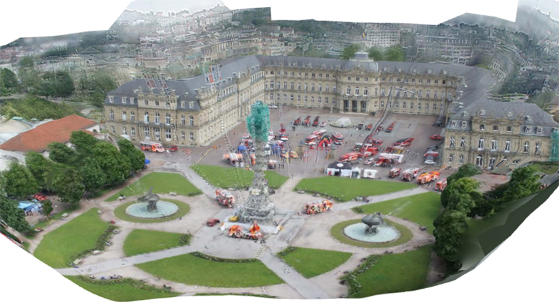
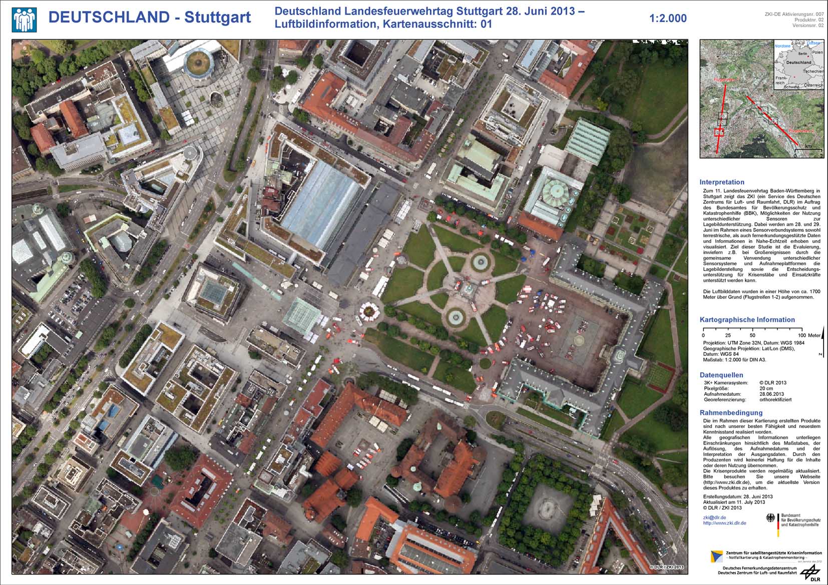
3D visualization of aerial images of the Schlossplatz in Stuttgart.
Credit:
DLR (CC-BY 3.0).
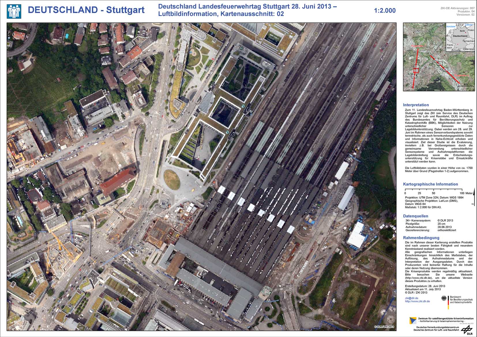
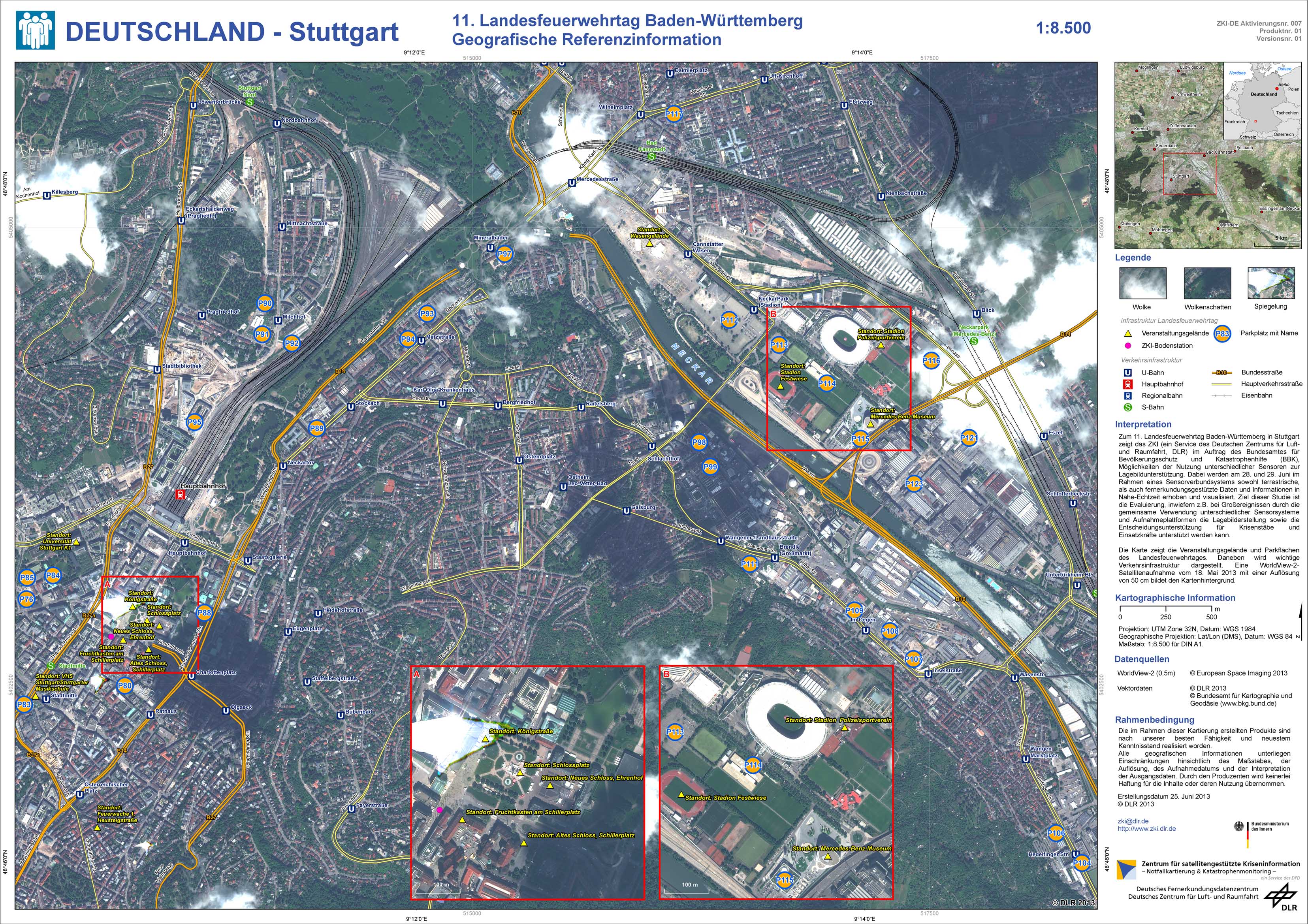
As the German Aerospace Center (DLR) in collaboration with the Federal Office of Civil Protection and Disaster Assistance (BBK) demonstrated in Stuttgart, Germany, remote sensing can significantly contribute to situation awareness in the context of civil defense. In the occasion of the Landesfeuerwehrtag in Stuttgart, DLR and BBK established a mobile situation room during June 28 and 29 2013. Several image products from different remote sensing platforms were allocated, preprocessed and analyzed. Meanwhile, interested attendants seized their chance to catch up on the work of DLRs scientists as well as to ask questions to them. In return, also DLR and BBK interviewed their guests in order to gather important knowledge for their further research. Is that made using a satellite? was probably the most frequently asked question emerged on the part of attendants taking a look on an image of the Schlossplatz in Stuttgart. Actually, this image is a product of DLRs air-borne 3K-camera system, which acquired optical imagery of the venue from 1700 meter height above ground. The imagery was immediately transferred to an antenna near the mobile ground station. Due to the fact that high buildings surrounded the ground station, the antenna had to be installed on a cherry picker from the fire brigade in order to ensure intervisibility of airplane and antenna. Additionally to air-borne imagery also a satellite image acquired a month before the event were demonstrated. This demonstration was arranged in the context of the national service ZKI-DE, which was established at the beginning of 2013 based on a frame contract between the Federal Ministry of the Interior (BMI) and the German Aerospace Center in order to provide the access to remote sensing information for all ancillary public authorities of the BMI.
Products
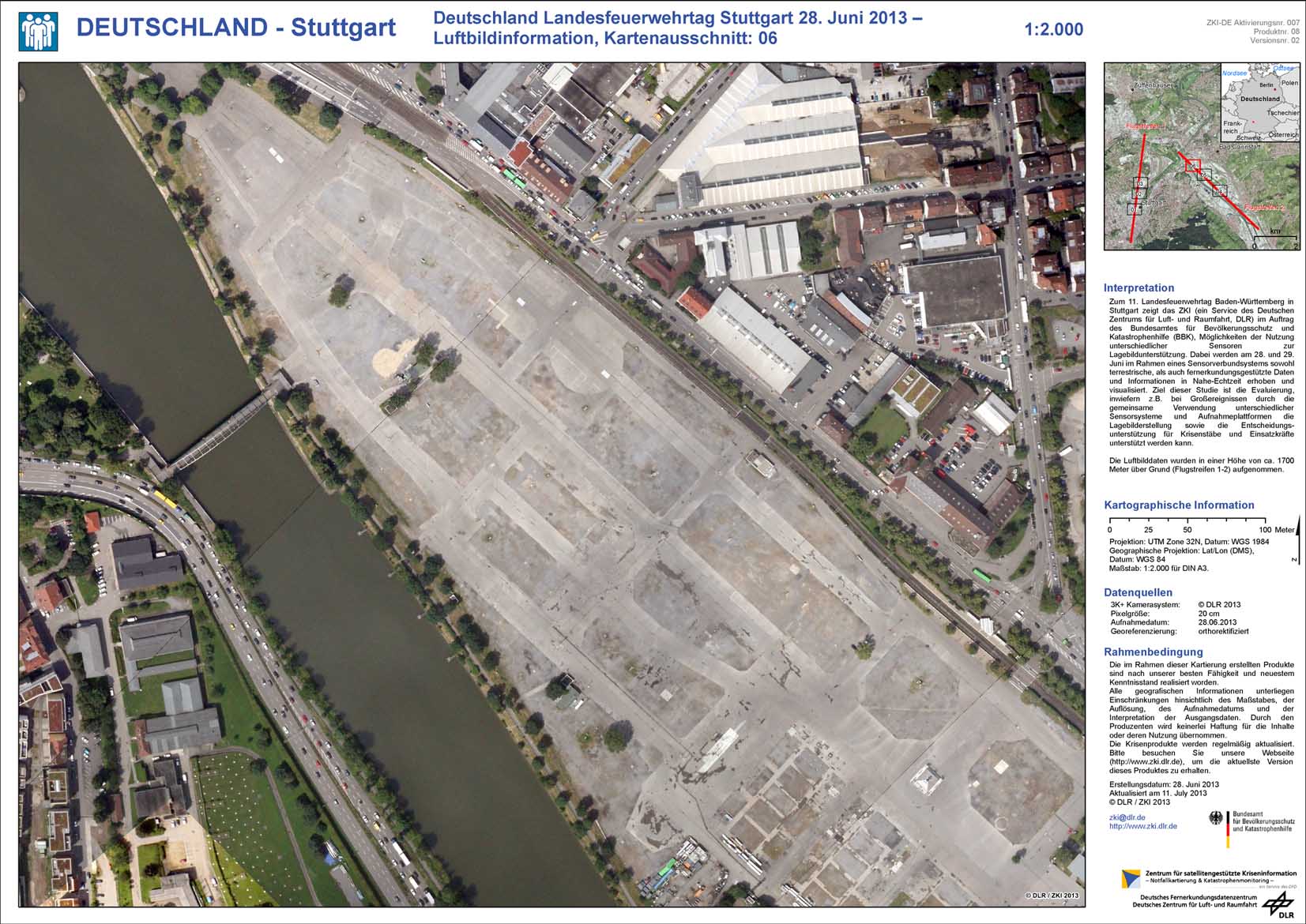
Germany - Stuttgart - P08 - State Fire Brigade Day June 28, 2013 - Aerial Image Information Map, tile: 06