Forest fires in Romania
undefined
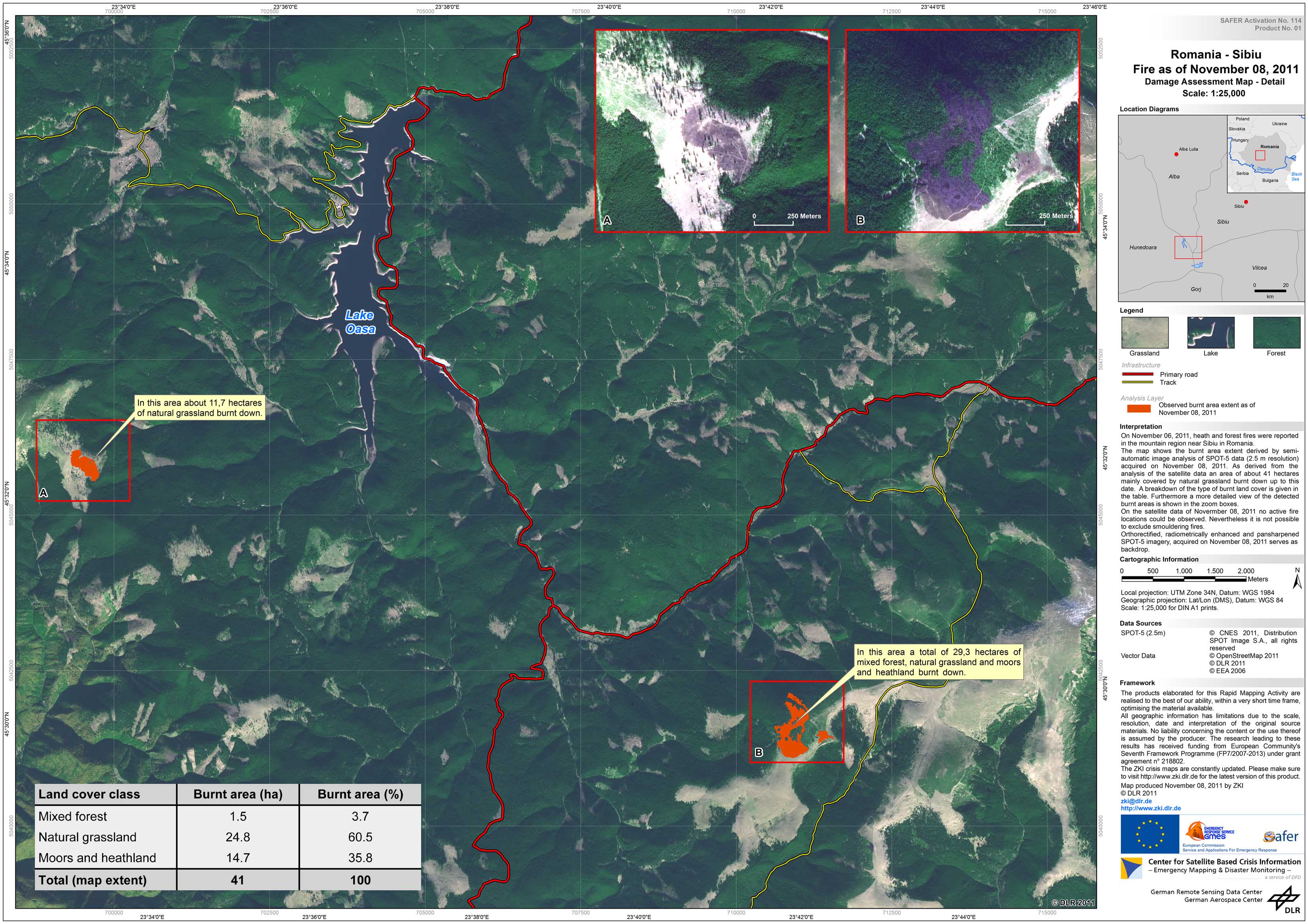
On November 06, 2011, heath and forest fires were reported in the mountain region near Sibiu in Romania. The map shows the burnt area extent derived by semi- automatic image analysis of SPOT-5 data (2.5 m resolution) acquired on November 08, 2011. As derived from the analysis of the satellite data an area of about 41 hectares mainly covered by natural grassland burnt down up to this date. Furthermore a more detailed view of the detected burnt areas is shown in the zoom boxes. On the satellite data of Novermber 08, 2011 no active fire locations could be observed. Nevertheless it is not possible to exclude smouldering fires. Orthorectified, radiometrically enhanced and pansharpened SPOT-5 imagery, acquired on November 08, 2011 serves as backdrop.
Romania - P01 - Sibiu - Damage Assessment Map - Detail
Creation Date 08. November 2011
undefined