Demonstration of traffic monitoring from space - Example case: Australian bushfires
undefined
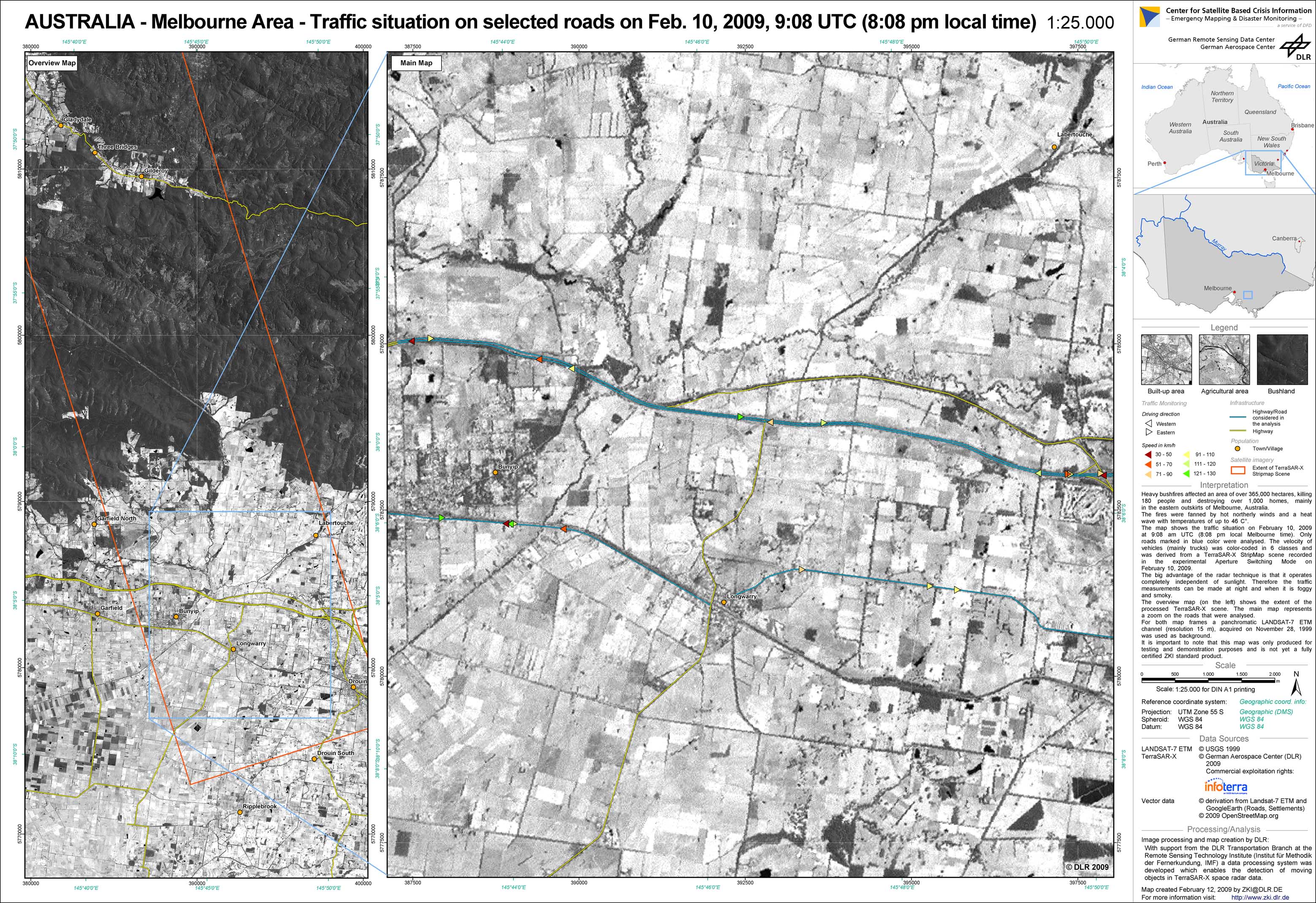
A traffic monitoring system developed by the Remote Sensing Technology Institute (IMF) of the German Aerospace Center (DLR) allows the monitoring of instantaneous traffic circulation also during disasters. This nearly fully automatic processor was tested by ZKI during the devastating bushfires in Australia in early February 2009. In catastrophes such as this, a safe knowledge which roads can still be used is very important. On the one hand, people may have to be evacuated and on the other hand, the fire brigades and ambulances must find their way into the disaster area. A good indicator of whether a road can be used is when it can be proven that there is ongoing traffic. The map shows the traffic situation on February 10, 2009, at 9:08 am UTC (08:08 pm local Melbourne time). The velocity of the vehicles (mainly trucks) was extracted from a TerraSAR-X StripMap scene recorded in experimental Aperture Switching Mode, which was commanded by the Microwave and Radar Institute of DLR. The scene which is located about 60km east of Melbourne was of special interest because the so-called “Bunyip Ridge Fire had jumped across the Princes Freeway which connects Melbourne with the south-eastern parts of Australia. This fire alone burned 25.000 hectares. The TerraSAR-X data take was positioned exactly over the affected area between the villages of Longwarry and Drouin. Due to the fire, some roads in the area had to be closed. The two roads which were analyzed are the Princes Freeway and an alternate and parallel road two kilometer to the south. It was proven that, at the time of snapshot from the radar satellite, these two roads were in normal use, because the detected vehicles go with common speed around 100 km/h. In large bushfires like this imaging radar is an ideal sensor because it can penetrate the clouds and smoke. The bushfires affected an area of over 365,000 hectares, killing 180 people and destroying over 1,000 homes, mainly in the eastern outskirts of Melbourne, Australia.
Australia - P01 - Traffic Monitoring Analysis east of Melbourne
Creation Date 12. February 2009
undefined